Geolocate

Bastrop County topographic map

Click on the map to display elevation.

About this map

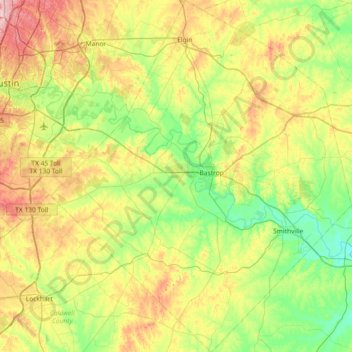
Name: Bastrop County topographic map, elevation, terrain.

Location: Bastrop County, Texas, United States (29.78654 -97.64906 30.41967 -97.02446)

Average elevation: 149 m

Minimum elevation: 81 m

Maximum elevation: 280 m

Gear up for your next adventure:

🪫Rechargeable Headlamps - USB rechargeable headlamps
🔪Camping Knives - Multi-purpose outdoor knives
🥤Hydration Packs - Hydration systems for hiking
📻Handheld UHF Radios - Critical communication for groups in the Australian outback
🧢Outdoor Sun Hats - Sun protection hats for hiking

As an Amazon Associate, this site earns from qualifying purchases at no extra cost to you.