
4824 topographic map
Interactive map
Click on the map to display elevation.
About this map
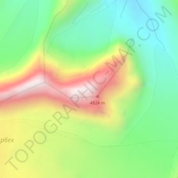
Name: 4824 topographic map, elevation, terrain.
Location: 4824, Чон-Алайский район, Osh Region, Kyrgyzstan (39.64197 71.66714 39.64207 71.66724)
Average elevation: 4,226 m
Minimum elevation: 3,833 m
Maximum elevation: 4,808 m
Other topographic maps
Click on a map to view its topography, its elevation and its terrain.
Кашкасу
Kyrgyzstan > Osh Region > Чон-Алайский район > Кашка-суу
Кашкасу, Кашка-суу, Чон-Алайский район, Osh Region, Kyrgyzstan
Average elevation: 3,455 m
Таш-Булак
Kyrgyzstan > Osh Region > Таш-Булак
Таш-Булак, Osh Region, Kyrgyzstan
Average elevation: 1,252 m