
La Serrana topographic map
Interactive map
Click on the map to display elevation.
About this map
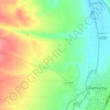
Name: La Serrana topographic map, elevation, terrain.
Location: La Serrana, Calamocha, Jiloca, Teruel, Aragón, 44495, España (40.91793 -1.32283 40.93793 -1.30283)
Average elevation: 903 m
Minimum elevation: 865 m
Maximum elevation: 950 m