
Río Ser topographic map
Interactive map
Click on the map to display elevation.
About this map
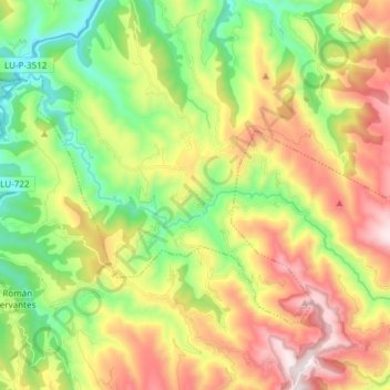
Name: Río Ser topographic map, elevation, terrain.
Location: Río Ser, Cervantes, Ancares, Lugo, Galicia, 27667, España (42.86520 -7.05557 42.93335 -6.90508)
Average elevation: 740 m
Minimum elevation: 313 m
Maximum elevation: 1,329 m
Other topographic maps
Click on a map to view its topography, its elevation and its terrain.