
Thank you for supporting this site ❤️
Make a donation
Make a donation
Gear up for your next adventure:
As an Amazon Associate, this site earns from qualifying purchases at no extra cost to you.
Weisshorn topographic map
Click on the map to display elevation.
Thank you for supporting this site ❤️
Make a donation
Make a donation
Gear up for your next adventure:
As an Amazon Associate, this site earns from qualifying purchases at no extra cost to you.
About this map
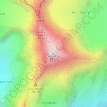
Name: Weisshorn topographic map, elevation, terrain.
Location: Weisshorn, Randa, Visp, Wallis, 3928, Switzerland (46.10118 7.71610 46.10128 7.71620)
Average elevation: 3,595 m
Minimum elevation: 2,894 m
Maximum elevation: 4,463 m
Thank you for supporting this site ❤️
Make a donation
Make a donation
Gear up for your next adventure:
As an Amazon Associate, this site earns from qualifying purchases at no extra cost to you.