
Mayūrbhanj topographic map
Interactive map
Click on the map to display elevation.
About this map
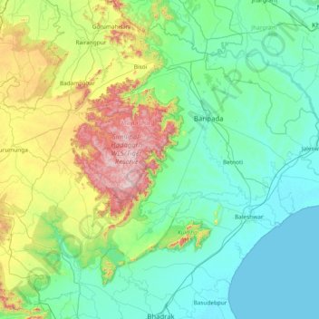
Name: Mayūrbhanj topographic map, elevation, terrain.
Location: Mayūrbhanj, Mayurbhanj District, Odisha, Índia (21.05000 85.80000 22.45000 87.20000)
Average elevation: 200 m
Minimum elevation: -1 m
Maximum elevation: 1,143 m
Other topographic maps
Click on a map to view its topography, its elevation and its terrain.