
Hanang topographic map
Interactive map
Click on the map to display elevation.
About this map
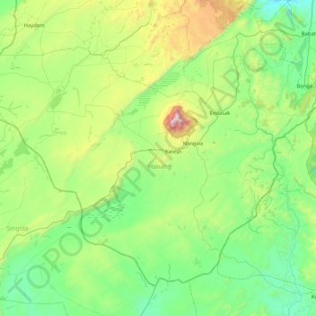
Name: Hanang topographic map, elevation, terrain.
Location: Hanang, Manyara, Northern Zone, Tanzania (-4.84910 34.85235 -4.23172 35.69079)
Average elevation: 1,593 m
Minimum elevation: 1,102 m
Maximum elevation: 3,352 m
Other topographic maps
Click on a map to view its topography, its elevation and its terrain.
Tarangire National Park
Tarangire National Park, Ridge Road, Babati, Manyara, Northern Zone, Tanzania
Average elevation: 1,252 m
Lake Manyara
Lake Manyara, Babati, Manyara, Northern Zone, Tanzania
Average elevation: 1,174 m