
Hurtebise topographic map
Interactive map
Click on the map to display elevation.
About this map
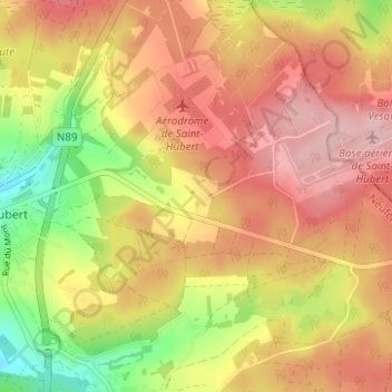
Name: Hurtebise topographic map, elevation, terrain.
Location: Hurtebise, Saint-Hubert, Luxembourg, Wallonie, 6870, Belgique (50.00694 5.38636 50.04694 5.42636)
Average elevation: 521 m
Minimum elevation: 425 m
Maximum elevation: 589 m