
Thank you for supporting this site ❤️
Make a donation
Make a donation
Gear up for your next adventure:
As an Amazon Associate, this site earns from qualifying purchases at no extra cost to you.
Lötschenpass topographic map
Click on the map to display elevation.
Thank you for supporting this site ❤️
Make a donation
Make a donation
Gear up for your next adventure:
As an Amazon Associate, this site earns from qualifying purchases at no extra cost to you.
About this map
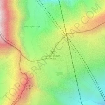
Name: Lötschenpass topographic map, elevation, terrain.
Location: Lötschenpass, Ferden, Westlich Raron, Wallis, 3916, Switzerland (46.41620 7.71667 46.41630 7.71677)
Average elevation: 2,683 m
Minimum elevation: 2,108 m
Maximum elevation: 3,432 m
Thank you for supporting this site ❤️
Make a donation
Make a donation
Gear up for your next adventure:
As an Amazon Associate, this site earns from qualifying purchases at no extra cost to you.