Geolocate

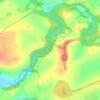
Fenwick topographic map

Click on the map to display elevation.

About this map

Name: Fenwick topographic map, elevation, terrain.

Location: Fenwick, East Ayrshire, Scotland, KA3 6DX, United Kingdom (55.64168 -4.46393 55.68168 -4.42393)

Average elevation: 142 m

Minimum elevation: 92 m

Maximum elevation: 207 m

Other topographic maps

Click on a map to view its topography, its elevation and its terrain.

Braid Wood

United Kingdom > Scotland > East Ayrshire

Average elevation: 114 m

Glenbuck Loch

United Kingdom > Scotland > East Ayrshire

Average elevation: 327 m

Loch Doon

United Kingdom > Scotland > East Ayrshire

Average elevation: 291 m

River Doon

United Kingdom > Scotland > East Ayrshire > Dalrymple

Average elevation: 168 m

River Ayr

United Kingdom > Scotland > East Ayrshire

Average elevation: 210 m

Gear up for your next adventure:

🧴Sunscreen SPF - Sun protection for outdoor activities
🧣Merino Neck Gaiters - Versatile headwear for warmth, sun protection, or dust filtering
🎒Dry Bags - Waterproof bags for outdoor gear
📡Satellite Messengers - Emergency communication devices
📡Portable Emergency Radios - Stay informed about weather warnings and bushfire alerts

As an Amazon Associate, this site earns from qualifying purchases at no extra cost to you.