
Julémont topographic map
Interactive map
Click on the map to display elevation.
About this map
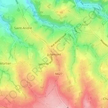
Name: Julémont topographic map, elevation, terrain.
Location: Julémont, Verviers, Luik, Wallonië, 4653, België (50.66564 5.75187 50.70564 5.79187)
Average elevation: 202 m
Minimum elevation: 118 m
Maximum elevation: 290 m