
京都市 topographic map
Interactive map
Click on the map to display elevation.
About this map
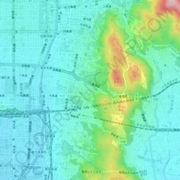
Name: 京都市 topographic map, elevation, terrain.
Location: 東山区, 京都市, Prefectura de Kioto, 近畿地方, Japón (34.96996 135.76464 35.01085 135.79114)
Average elevation: 79 m
Minimum elevation: 22 m
Maximum elevation: 299 m