Geolocate

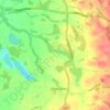
Siddington topographic map

Click on the map to display elevation.

About this map

Name: Siddington topographic map, elevation, terrain.

Location: Siddington, Cheshire East, England, United Kingdom (53.21937 -2.25986 53.26109 -2.19632)

Average elevation: 99 m

Minimum elevation: 58 m

Maximum elevation: 142 m

Other topographic maps

Click on a map to view its topography, its elevation and its terrain.
Gear up for your next adventure:

🔦LED Torches - LED torches for outdoor use
🎒Daypacks - Compact backpacks for short hikes
🕶️Polarized Outdoor Sunglasses - Reduce glare from rocks and water for better visual navigation
🌬️Windbreaker Jackets - Wind protection jackets
⌛Survival Blankets - Emergency thermal blankets

As an Amazon Associate, this site earns from qualifying purchases at no extra cost to you.