Geolocate

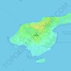
Snæbum topographic map

Click on the map to display elevation.

About this map

Name: Snæbum topographic map, elevation, terrain.

Location: Snæbum, Mariagerfjord Municipality, North Denmark Region, Denmark (56.62453 9.62572 56.66453 9.66572)

Average elevation: 44 m

Minimum elevation: 15 m

Maximum elevation: 77 m

Other topographic maps

Click on a map to view its topography, its elevation and its terrain.

Skivum

Denmark > North Denmark Region

Average elevation: 32 m

Pebermosen

Denmark > North Denmark Region > Grindsted > Vandsted

Average elevation: 39 m

Læsø

Denmark > North Denmark Region

Average elevation: 1 m

Lindholm Høje

Denmark > North Denmark Region > Aalborg

Average elevation: 14 m

Vendsyssel

Denmark > North Denmark Region

Average elevation: 10 m

Mors

Denmark > North Denmark Region

Average elevation: 12 m

Bulbjerg

Denmark > North Denmark Region

Average elevation: 8 m

Egholm

Denmark > North Denmark Region > Aalborg

Average elevation: 1 m

Gear up for your next adventure:

📸Action Cameras - Record your journey across interesting topographic features in 4K
🥤Hydration Packs - Hydration systems for hiking
🔥Windproof Plasma Lighters - USB rechargeable lighters that work in high-altitude winds
🎒3L Hydration Reservoirs - Hands-free drinking to stay hydrated on steep contour climbs
🔦Powerful LED Headlamps - Hands-free lighting for night navigation and setting up camp after dark

As an Amazon Associate, this site earns from qualifying purchases at no extra cost to you.