Geolocate

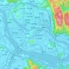
Tong'an topographic map

Click on the map to display elevation.

About this map

Name: Tong'an topographic map, elevation, terrain.

Location: Tong'an, Fuzhou City, Fujian, China (25.79646 118.71701 25.87646 118.79701)

Average elevation: 739 m

Minimum elevation: 467 m

Maximum elevation: 1,067 m

Other topographic maps

Click on a map to view its topography, its elevation and its terrain.

Fuqing City

China > Fujian > Fuzhou City

Average elevation: 101 m

Cangshan District

China > Fujian > Fuzhou City

Average elevation: 76 m

Gear up for your next adventure:

🌿Flora and Fauna Field Guides - Identify the plants and animals you encounter on your route
🧭Military Style Lensatic Compass - Durable sighting compasses for advanced land navigation and surveying
🎒Hiking Backpacks - Backpacks designed for hiking and trekking
📖Australian Bush Survival Books - Local knowledge on finding water and surviving the outback
📱Tablet Tripod Mounts - Steady platforms for viewing digital maps or taking long exposures

As an Amazon Associate, this site earns from qualifying purchases at no extra cost to you.