Geolocate

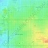
Sentinel Peak topographic map

Click on the map to display elevation.

About this map

Name: Sentinel Peak topographic map, elevation, terrain.

Location: Sentinel Peak, Tucson, Pima County, Arizona, 85701, United States (32.21020 -110.99239 32.21030 -110.99229)

Average elevation: 746 m

Minimum elevation: 712 m

Maximum elevation: 949 m

Other topographic maps

Click on a map to view its topography, its elevation and its terrain.

Catalina Foothills

United States > Arizona > Pima County > Tucson

Average elevation: 949 m

Himmel Park

United States > Arizona > Pima County > Tucson

Average elevation: 752 m

Catalina Foothills

United States > Arizona > Pima County > Tucson

Average elevation: 949 m

West University

United States > Arizona > Pima County > Tucson

Average elevation: 734 m

Mitchell Park

United States > Arizona > Pima County > Tucson

Average elevation: 731 m

Gear up for your next adventure:

🧊Insulated Cooler Bags - Keep food fresh for day trips to remote geographic sites
📡Weather Radios - Emergency weather radios
⛺Lightweight Tents - Compact tents for backpacking
🥤Hydration Packs - Hydration systems for hiking
🦶Orthotic Hiking Insoles - Extra arch support for long-distance topographic treks

As an Amazon Associate, this site earns from qualifying purchases at no extra cost to you.