Geolocate

Whitfield topographic map

Click on the map to display elevation.

About this map
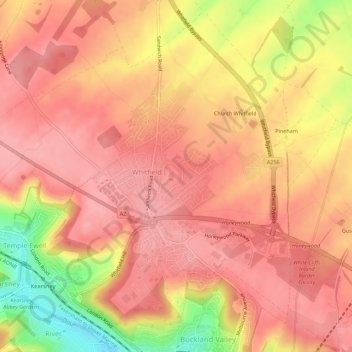
Name: Whitfield topographic map, elevation, terrain.

Location: Whitfield, Dover, Kent, England, United Kingdom (51.14259 1.26325 51.17555 1.31859)

Average elevation: 101 m

Minimum elevation: 21 m

Maximum elevation: 133 m

Gear up for your next adventure:

🪢Paracord - Multi-purpose survival cord
🔦LED Torches - LED torches for outdoor use
🎒Tactical Waist Packs - Quick access to your compass, phone, and snacks while walking
💧Personal Water Filters - Drink safely from streams and lakes identified on your map
🌧️Rain Jackets - Waterproof jackets for hiking

As an Amazon Associate, this site earns from qualifying purchases at no extra cost to you.