
Шестерин овраг topographic map
Interactive map
Click on the map to display elevation.
About this map
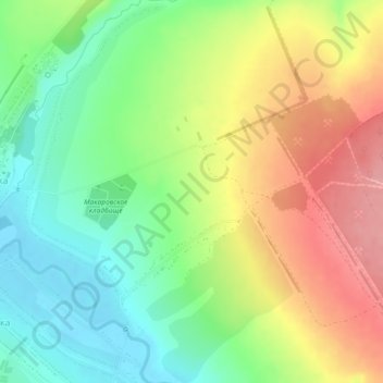
Name: Шестерин овраг topographic map, elevation, terrain.
Average elevation: 189 m
Minimum elevation: 138 m
Maximum elevation: 254 m
Other topographic maps
Click on a map to view its topography, its elevation and its terrain.
Saransk
Russia > Republic of Mordovia > Saransk Urban District
Saransk, Saransk Urban District, Republic of Mordovia, Volga Federal District, 430000, Russia
Average elevation: 174 m