
香日德镇 topographic map
Interactive map
Click on the map to display elevation.
About this map
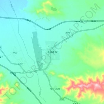
Name: 香日德镇 topographic map, elevation, terrain.
Location: 香日德镇, 都兰县, 海西蒙古族藏族自治州, 青海省, 中国 (35.95466 97.84796 36.03466 97.92796)
Average elevation: 3,127 m
Minimum elevation: 3,037 m
Maximum elevation: 3,465 m
Other topographic maps
Click on a map to view its topography, its elevation and its terrain.