
Thank you for supporting this site ❤️
Make a donation
Make a donation
Gear up for your next adventure:
As an Amazon Associate, this site earns from qualifying purchases at no extra cost to you.
Trascastro topographic map
Click on the map to display elevation.
Thank you for supporting this site ❤️
Make a donation
Make a donation
Gear up for your next adventure:
As an Amazon Associate, this site earns from qualifying purchases at no extra cost to you.
About this map
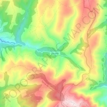
Name: Trascastro topographic map, elevation, terrain.
Location: Trascastro, O Incio, Sarria, Lugo, Galicia, 27347, Spain (42.60808 -7.34257 42.66676 -7.26927)
Average elevation: 896 m
Minimum elevation: 541 m
Maximum elevation: 1,298 m
Thank you for supporting this site ❤️
Make a donation
Make a donation
Gear up for your next adventure:
As an Amazon Associate, this site earns from qualifying purchases at no extra cost to you.