
Brinkin topographic map
Interactive map
Click on the map to display elevation.
About this map
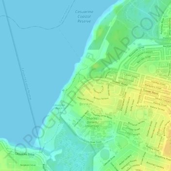
Name: Brinkin topographic map, elevation, terrain.
Location: Brinkin, City of Darwin, Northern Territory, Australia (-12.37656 130.85470 -12.35468 130.87476)
Average elevation: 9 m
Minimum elevation: -1 m
Maximum elevation: 26 m
City of Darwin trails, hiking, mountain biking, running and outdoor activities
Other topographic maps
Click on a map to view its topography, its elevation and its terrain.