Geolocate

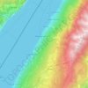
Spiazzi topographic map

Click on the map to display elevation.

About this map

Name: Spiazzi topographic map, elevation, terrain.

Location: Spiazzi, Caprino Veronese, Verona, Veneto, Italy (45.62780 10.83241 45.66780 10.87241)

Average elevation: 709 m

Minimum elevation: 102 m

Maximum elevation: 1,326 m

Other topographic maps

Click on a map to view its topography, its elevation and its terrain.
Brenzone sul Garda

Italy > Veneto > Verona

Average elevation: 683 m

Lazise

Italy > Veneto > Verona

Average elevation: 101 m

Bardolino

Italy > Veneto > Verona > Bardolino

Average elevation: 117 m

Sommacampagna

Italy > Veneto > Verona

Average elevation: 90 m

Mozzecane

Italy > Veneto > Verona

Average elevation: 47 m

Cerea

Italy > Veneto > Verona

Average elevation: 14 m

Nogara

Italy > Veneto > Verona

Average elevation: 19 m

Sant'Anna d'Alfaedo

Italy > Veneto > Verona

Average elevation: 836 m

Colognola ai Colli

Italy > Veneto > Verona

Average elevation: 65 m

Minerbe

Italy > Veneto > Verona

Average elevation: 16 m

Isola del Sogno

Italy > Veneto > Verona > Cassone

Average elevation: 152 m

Veronella

Italy > Veneto > Verona

Average elevation: 21 m

Gear up for your next adventure:

🧴Sunscreen SPF - Sun protection for outdoor activities
🧦Merino Wool Hiking Socks - Moisture-wicking socks to prevent blisters during long topographic surveys
🌬️Windbreaker Jackets - Wind protection jackets
🧊Insulated Stainless Steel Flasks - Keep water cold for 24 hours in the heat or coffee hot in the cold
📦Crushproof Equipment Cases - Safe transport for sensitive surveying and mapping instruments

As an Amazon Associate, this site earns from qualifying purchases at no extra cost to you.