
Thank you for supporting this site ❤️
Make a donation
Make a donation
Gear up for your next adventure:
As an Amazon Associate, this site earns from qualifying purchases at no extra cost to you.
Savigny topographic map
Click on the map to display elevation.
Thank you for supporting this site ❤️
Make a donation
Make a donation
Gear up for your next adventure:
As an Amazon Associate, this site earns from qualifying purchases at no extra cost to you.
About this map
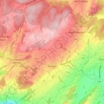
Name: Savigny topographic map, elevation, terrain.
Location: Savigny, District de Lavaux-Oron, Vaud, 1073, Switzerland (46.51793 6.69797 46.57386 6.75567)
Average elevation: 798 m
Minimum elevation: 621 m
Maximum elevation: 909 m
Thank you for supporting this site ❤️
Make a donation
Make a donation
Gear up for your next adventure:
As an Amazon Associate, this site earns from qualifying purchases at no extra cost to you.