

Make a donation
Gear up for your next adventure:
As an Amazon Associate, this site earns from qualifying purchases at no extra cost to you.
Monza topographic map
Click on the map to display elevation.
Make a donation
Gear up for your next adventure:
As an Amazon Associate, this site earns from qualifying purchases at no extra cost to you.
Monza
Monza is located in the high plains of Lombardy, between Brianza and Milan, at an altitude of 162 metres (531 feet) above sea level. It is 15 kilometres (9 mi) from the centre of the region's capital, although when considering the cities borders, they are separated by less than 5 km (3 miles). Monza is about 40 km (25 mi) from Lecco and Como. Monza shares its position with Milan in the same metro area, and is a big part of its new province.
Make a donation
Gear up for your next adventure:
As an Amazon Associate, this site earns from qualifying purchases at no extra cost to you.
About this map
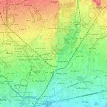
Name: Monza topographic map, elevation, terrain.
Location: Monza, Monza and Brianza, Lombardy, 20900, Italy (45.55326 9.22703 45.63220 9.32439)
Average elevation: 175 m
Minimum elevation: 145 m
Maximum elevation: 217 m
Make a donation
Gear up for your next adventure:
As an Amazon Associate, this site earns from qualifying purchases at no extra cost to you.