
Ega topographic map
Interactive map
Click on the map to display elevation.
About this map
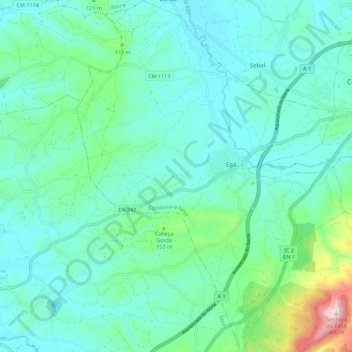
Name: Ega topographic map, elevation, terrain.
Location: Ega, Condeixa-a-Nova, Coímbra, Portugal (40.05107 -8.59145 40.13598 -8.50662)
Average elevation: 75 m
Minimum elevation: 1 m
Maximum elevation: 405 m