Geolocate

Beijin topographic map

Click on the map to display elevation.

About this map

Name: Beijin topographic map, elevation, terrain.

Location: Beijin, Jiangmen, Guangdong, China (21.83093 112.53370 21.87093 112.57370)

Average elevation: 19 m

Minimum elevation: -5 m

Maximum elevation: 181 m

Other topographic maps

Click on a map to view its topography, its elevation and its terrain.
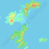
Shangchuan Island

China > Guangdong > Jiangmen

Average elevation: 27 m

Gear up for your next adventure:

🐍Australian Snake Bite Kits - Specific pressure immobilization bandages for Australian venomous snakes
📍Handheld GPS - GPS devices for hiking and navigation
🥾Hiking Gaiters - Leg protection for trails
🏃Compression Recovery Socks - Reduce leg fatigue after heavy days of elevation gain
🌧️Rain Jackets - Waterproof jackets for hiking

As an Amazon Associate, this site earns from qualifying purchases at no extra cost to you.