
Rivière topographic map
Interactive map
Click on the map to display elevation.
About this map
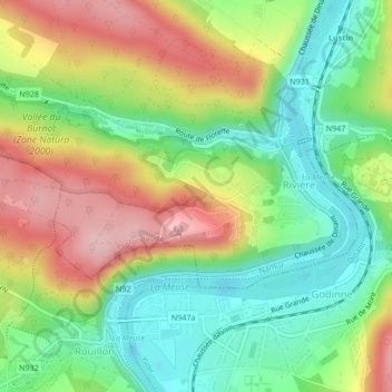
Name: Rivière topographic map, elevation, terrain.
Location: Rivière, Profondeville, Namur, Wallonie, Belgique (50.35089 4.84334 50.36361 4.87872)
Average elevation: 161 m
Minimum elevation: 74 m
Maximum elevation: 281 m
Other topographic maps
Click on a map to view its topography, its elevation and its terrain.
Émetteur RTBF de Profondeville
Belgique > Namur > Namur > Rivière
Émetteur RTBF de Profondeville, Sart à Soile, Rivière, Profondeville, Namur, Wallonie, 5160, Belgique
Average elevation: 152 m