Geolocate

Natone topographic map

Click on the map to display elevation.

About this map

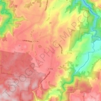
Name: Natone topographic map, elevation, terrain.

Location: Natone, City of Burnie, Tasmania, Australia (-41.20247 145.90358 -41.14004 145.96246)

Average elevation: 244 m

Minimum elevation: 44 m

Maximum elevation: 374 m

Tasmania trails, hiking, mountain biking, running and outdoor activities

Gear up for your next adventure:

🧊Insulated Stainless Steel Flasks - Keep water cold for 24 hours in the heat or coffee hot in the cold
🦟Insect Repellent - Protection against insects
🥶Thermal Beanies - Warm hats for cold hikes
📖Australian Bush Survival Books - Local knowledge on finding water and surviving the outback
🖼️Scratch-off Australia Map - Track the regions and peaks you have explored geographically

As an Amazon Associate, this site earns from qualifying purchases at no extra cost to you.