
Westfeld topographic map
Interactive map
Click on the map to display elevation.
About this map
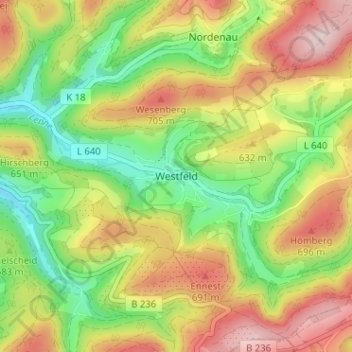
Name: Westfeld topographic map, elevation, terrain.
Average elevation: 594 m
Minimum elevation: 450 m
Maximum elevation: 763 m
Die Ortschaft liegt, auf einer Höhe zwischen 480 und 540 m ü. NHN, im oberen Lennetal am Fuße des Hohen Knochen.