
Bremsdorf topographic map
Interactive map
Click on the map to display elevation.
About this map
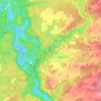
Name: Bremsdorf topographic map, elevation, terrain.
Location: Bremsdorf, Schlaubetal, Oder-Spree, Brandenburg, Deutschland (52.11590 14.44290 52.16811 14.51326)
Average elevation: 100 m
Minimum elevation: 47 m
Maximum elevation: 148 m