Geolocate

Oxted topographic map

Click on the map to display elevation.

About this map
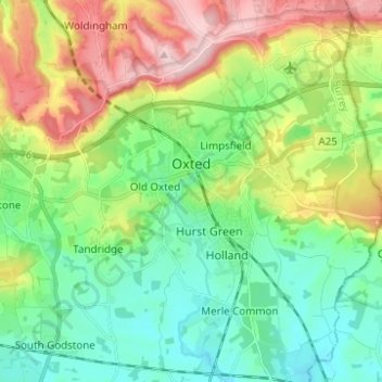
Name: Oxted topographic map, elevation, terrain.

Location: Oxted, Limpsfield, Tandridge, Surrey, England, United Kingdom (51.21233 -0.03626 51.28976 0.01667)

Average elevation: 128 m

Minimum elevation: 54 m

Maximum elevation: 271 m

Gear up for your next adventure:

🥤Hydration Packs - Hydration systems for hiking
🎒Daypacks - Compact backpacks for short hikes
🥾Hiking Boots - Durable hiking boots for trails and rough terrain
🧥Softshell Jackets - Flexible outdoor jackets
💡Collapsible Camping Lanterns - Illuminate your base camp or tent for map studying at night

As an Amazon Associate, this site earns from qualifying purchases at no extra cost to you.