
Thank you for supporting this site ❤️
Make a donation
Make a donation
Gear up for your next adventure:
As an Amazon Associate, this site earns from qualifying purchases at no extra cost to you.
Hockessin topographic map
Click on the map to display elevation.
Thank you for supporting this site ❤️
Make a donation
Make a donation
Gear up for your next adventure:
As an Amazon Associate, this site earns from qualifying purchases at no extra cost to you.
About this map
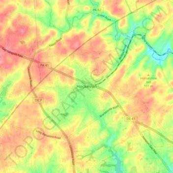
Name: Hockessin topographic map, elevation, terrain.
Location: Hockessin, New Castle County, Delaware, United States (39.76150 -75.72500 39.81360 -75.63489)
Average elevation: 93 m
Minimum elevation: 33 m
Maximum elevation: 135 m
Thank you for supporting this site ❤️
Make a donation
Make a donation
Gear up for your next adventure:
As an Amazon Associate, this site earns from qualifying purchases at no extra cost to you.
Other topographic maps
Click on a map to view its topography, its elevation and its terrain.
Meeting House Meadows
United States > Delaware > New Castle County > Hockessin
Average elevation: 95 m