
Palhères topographic map
Interactive map
Click on the map to display elevation.
About this map
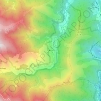
Name: Palhères topographic map, elevation, terrain.
Average elevation: 956 m
Minimum elevation: 522 m
Maximum elevation: 1,487 m
Other topographic maps
Click on a map to view its topography, its elevation and its terrain.
Chantegrive
France > Occitanie > Lozère > Pourcharesses
Chantegrive, Pourcharesses, Mende, Lozère, Occitanie, France métropolitaine, 48800, France
Average elevation: 1,401 m