Geolocate

Meerssen topographic map

Click on the map to display elevation.

About this map

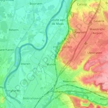
Name: Meerssen topographic map, elevation, terrain.

Location: Meerssen, Limburg, Netherlands (50.86597 5.71248 50.94341 5.80348)

Average elevation: 66 m

Minimum elevation: 33 m

Maximum elevation: 136 m

Gear up for your next adventure:

🥶Thermal Beanies - Warm hats for cold hikes
📷Backpack Camera Clips - Quick access to your camera while keeping your hands free for climbing
🏃Compression Recovery Socks - Reduce leg fatigue after heavy days of elevation gain
🕶️Polarized Outdoor Sunglasses - Reduce glare from rocks and water for better visual navigation
🧥Thermal Emergency Blankets - Compact Mylar blankets to prevent hypothermia if stranded overnight

As an Amazon Associate, this site earns from qualifying purchases at no extra cost to you.