Geolocate

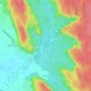
Sector 84 topographic map

Click on the map to display elevation.

About this map

Name: Sector 84 topographic map, elevation, terrain.

Location: Sector 84, Gurgaon, Gurugram, Haryana, India (28.39923 76.95471 28.41718 76.97282)

Average elevation: 227 m

Minimum elevation: 218 m

Maximum elevation: 236 m

Other topographic maps

Click on a map to view its topography, its elevation and its terrain.

Badshahpur

India > Haryana > Gurgaon

Average elevation: 228 m

Damdama Lake

India > Haryana > Gurgaon

Average elevation: 242 m

Gear up for your next adventure:

🔦LED Torches - LED torches for outdoor use
🧭Global Orienteering Compass - High-precision liquid-filled compasses for accurate map reading and navigation
👖Convertible Hiking Trousers - Zip-off legs to adapt to changing temperatures throughout the day
🩹Blister Prevention Tape - Apply to friction points before they become painful sores
🎒Tactical Waist Packs - Quick access to your compass, phone, and snacks while walking

As an Amazon Associate, this site earns from qualifying purchases at no extra cost to you.