
Thank you for supporting this site ❤️
Make a donation
Make a donation
Gear up for your next adventure:
As an Amazon Associate, this site earns from qualifying purchases at no extra cost to you.
Ambleston topographic map
Click on the map to display elevation.
Thank you for supporting this site ❤️
Make a donation
Make a donation
Gear up for your next adventure:
As an Amazon Associate, this site earns from qualifying purchases at no extra cost to you.
About this map
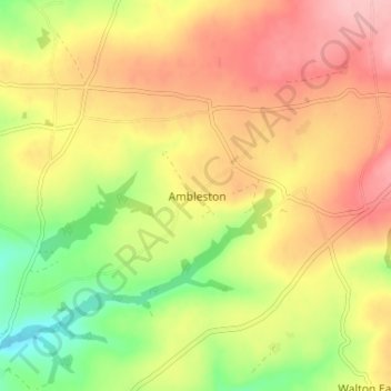
Name: Ambleston topographic map, elevation, terrain.
Location: Ambleston, Pembrokeshire, Wales, SA62 5QY, United Kingdom (51.87498 -4.92668 51.91498 -4.88668)
Average elevation: 129 m
Minimum elevation: 54 m
Maximum elevation: 194 m
Thank you for supporting this site ❤️
Make a donation
Make a donation
Gear up for your next adventure:
As an Amazon Associate, this site earns from qualifying purchases at no extra cost to you.