Geolocate

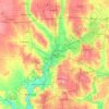
Centerville topographic map

Click on the map to display elevation.

Centerville

In 1913, Centerville sustained minimal damage during the Great Flood of 1913 due to its relatively high elevation. The city sits on one of the highest points in Montgomery County.

Wikipedia (CC-BY-SA 3.0)

About this map

Name: Centerville topographic map, elevation, terrain.

Location: Centerville, Montgomery County, Ohio, United States (39.59062 -84.20869 39.67385 -84.09909)

Average elevation: 287 m

Minimum elevation: 226 m

Maximum elevation: 323 m

Other topographic maps

Click on a map to view its topography, its elevation and its terrain.
Bridgeport

United States > Ohio > Montgomery County > Miamisburg

Average elevation: 243 m

Hearthstone

United States > Ohio > Montgomery County > Dayton

Average elevation: 273 m

Greenmont

United States > Ohio > Montgomery County > Kettering

Average elevation: 282 m

Cornell Heights

United States > Ohio > Montgomery County > Dayton

Average elevation: 256 m

Avondale

United States > Ohio > Montgomery County > Riverside

Average elevation: 238 m

Woodbourne

United States > Ohio > Montgomery County

Average elevation: 291 m

Dayton

United States > Ohio > Montgomery County > Dayton

Average elevation: 270 m

Oakdale

United States > Ohio > Montgomery County > Kettering

Average elevation: 297 m

Patterson

United States > Ohio > Montgomery County > Dayton

Average elevation: 233 m

Fort McKinley

United States > Ohio > Montgomery County > Dayton

Average elevation: 273 m

Shakertown

United States > Ohio > Montgomery County > Kettering

Average elevation: 282 m

North Riverdale

United States > Ohio > Montgomery County > Dayton

Average elevation: 254 m

Oakland

United States > Ohio > Montgomery County > Dayton

Average elevation: 269 m

Gear up for your next adventure:

🧥Softshell Jackets - Flexible outdoor jackets
🔋Solar Power Banks - Charge your phone and GPS using the sun while deep in the bush
🔦Powerful LED Headlamps - Hands-free lighting for night navigation and setting up camp after dark
📟Satellite Messengers - Two-way satellite communication to stay in touch beyond the cellular grid
🔥Windproof Plasma Lighters - USB rechargeable lighters that work in high-altitude winds

As an Amazon Associate, this site earns from qualifying purchases at no extra cost to you.