Geolocate

Konya topographic map

Click on the map to display elevation.

About this map
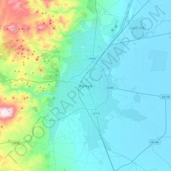
Name: Konya topographic map, elevation, terrain.

Location: Konya, Selçuklu, Konya, Central Anatolia Region, 42040, Turkey (37.71273 32.33244 38.03273 32.65244)

Average elevation: 1,160 m

Minimum elevation: 999 m

Maximum elevation: 2,052 m

Other topographic maps

Click on a map to view its topography, its elevation and its terrain.

Sille Mahallesi

Turkey > Selçuklu

Average elevation: 1,267 m

Aşağıpınarbaşı Mahallesi

Turkey > Selçuklu

Average elevation: 1,027 m

Gear up for your next adventure:

🧭Compass - Navigation compasses for outdoor exploration
⛺Ultralight Solo Tents - Compact shelters for multi-day topographic surveying expeditions
📸Action Cameras - Record your journey across interesting topographic features in 4K
🌧️Rain Jackets - Waterproof jackets for hiking
🥤Outdoor Water Bottles - Reusable bottles for outdoor activities

As an Amazon Associate, this site earns from qualifying purchases at no extra cost to you.