
Kingston topographic map
Interactive map
Click on the map to display elevation.
About this map
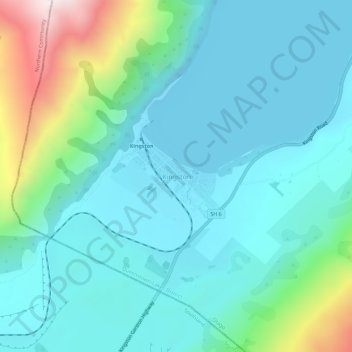
Name: Kingston topographic map, elevation, terrain.
Location: Kingston, Queenstown-Lakes District, Otago, New Zealand (-45.35437 168.69751 -45.31437 168.73751)
Average elevation: 507 m
Minimum elevation: 305 m
Maximum elevation: 1,334 m
Other topographic maps
Click on a map to view its topography, its elevation and its terrain.