Geolocate

Barlo topographic map

Click on the map to display elevation.

About this map
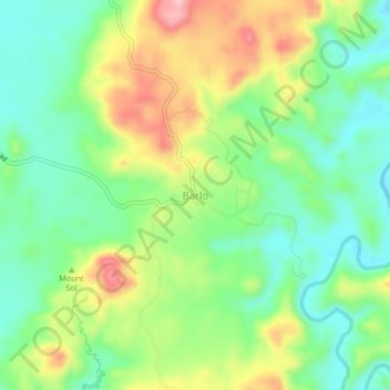
Name: Barlo topographic map, elevation, terrain.

Location: Barlo, Pangasinan, Ilocos Region, Philippines (15.97093 119.92657 16.01093 119.96657)

Average elevation: 95 m

Minimum elevation: 24 m

Maximum elevation: 210 m

Gear up for your next adventure:

🍴Titanium Spork & Cutlery - Indestructible and feather-light eating utensils
🚁Camera Drones with GPS - Capture aerial views of the landscape to compare with topo maps
🔑Heavy Duty Carabiners - Secure gear to the outside of your pack for easy access
🧤Thermal Hiking Gloves - Keep your hands warm and functional during high-altitude winter treks
🔭Compact Hiking Binoculars - Lightweight optics for scouting routes or birdwatching

As an Amazon Associate, this site earns from qualifying purchases at no extra cost to you.