
Lac Pierre topographic map
Interactive map
Click on the map to display elevation.
About this map
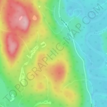
Name: Lac Pierre topographic map, elevation, terrain.
Average elevation: 317 m
Minimum elevation: 250 m
Maximum elevation: 418 m
Other topographic maps
Click on a map to view its topography, its elevation and its terrain.
Lac Gravel
Canada > Québec > Mont-Saint-Michel
Lac Gravel, Montée du Lac-Gravel, Mont-Saint-Michel, Antoine-Labelle, Laurentides, Québec, Canada
Average elevation: 282 m