Geolocate

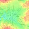
Pickerington topographic map

Click on the map to display elevation.

About this map

Name: Pickerington topographic map, elevation, terrain.

Location: Pickerington, Violet Township, Fairfield County, Ohio, 43147, United States (39.85720 -82.80447 39.93548 -82.73020)

Average elevation: 268 m

Minimum elevation: 233 m

Maximum elevation: 325 m

Other topographic maps

Click on a map to view its topography, its elevation and its terrain.
Geneva

United States > Ohio > Fairfield County

Average elevation: 276 m

Walnut Creek

United States > Ohio > Fairfield County > Baltimore

Average elevation: 280 m

Pleasant Hill

United States > Ohio > Fairfield County

Average elevation: 292 m

Rising Park

United States > Ohio > Fairfield County > Lancaster

Average elevation: 274 m

Hooker

United States > Ohio > Fairfield County

Average elevation: 262 m

Gear up for your next adventure:

🦯Trekking Poles - Walking poles for hiking stability
🔌Fast Charging Adapters - Quickly top up all your gear before heading back into the field
🍳Ultralight Camping Stoves - Boil water quickly for meals using minimal fuel
🧳Outdoor Travel Organizers - Gear organization accessories
🥾Heavy Duty Hiking Boots - Ankle-supporting boots for carrying heavy packs on steep contours

As an Amazon Associate, this site earns from qualifying purchases at no extra cost to you.