
Mutara topographic map
Interactive map
Click on the map to display elevation.
About this map
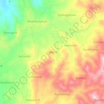
Name: Mutara topographic map, elevation, terrain.
Location: Mutara, Rukungiri, Western Region, Uganda (-0.76421 29.90788 -0.72421 29.94788)
Average elevation: 1,657 m
Minimum elevation: 1,450 m
Maximum elevation: 1,845 m