
Cochise County topographic map
Interactive map
Click on the map to display elevation.
About this map
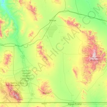
Name: Cochise County topographic map, elevation, terrain.
Location: Cochise County, Arizona, Verenigde Staten van Amerika (31.33241 -110.45646 32.42769 -109.04769)
Average elevation: 1,410 m
Minimum elevation: 859 m
Maximum elevation: 2,959 m
Other topographic maps
Click on a map to view its topography, its elevation and its terrain.
Galloway Canyon
Verenigde Staten van Amerika > Arizona
Galloway Canyon, Coconino County, Arizona, Verenigde Staten van Amerika
Average elevation: 1,382 m
Coconino County
Verenigde Staten van Amerika > Arizona
Coconino County, Arizona, Verenigde Staten van Amerika
Average elevation: 1,725 m