
Thank you for supporting this site ❤️
Make a donation
Make a donation
Gear up for your next adventure:
As an Amazon Associate, this site earns from qualifying purchases at no extra cost to you.
Pana topographic map
Click on the map to display elevation.
Thank you for supporting this site ❤️
Make a donation
Make a donation
Gear up for your next adventure:
As an Amazon Associate, this site earns from qualifying purchases at no extra cost to you.
About this map
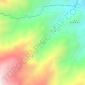
Name: Pana topographic map, elevation, terrain.
Location: Pana, Mamasa, West Sulawesi, Sulawesi, Indonesia (-3.07083 119.50480 -3.03083 119.54480)
Average elevation: 1,418 m
Minimum elevation: 822 m
Maximum elevation: 2,244 m
Thank you for supporting this site ❤️
Make a donation
Make a donation
Gear up for your next adventure:
As an Amazon Associate, this site earns from qualifying purchases at no extra cost to you.