Geolocate

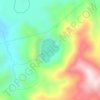
Pamatawan topographic map

Click on the map to display elevation.

About this map

Name: Pamatawan topographic map, elevation, terrain.

Location: Pamatawan, Subic, Zambales, Central Luzon, 2208, Philippines (14.90439 120.20037 14.94439 120.24037)

Average elevation: 74 m

Minimum elevation: 14 m

Maximum elevation: 267 m

Other topographic maps

Click on a map to view its topography, its elevation and its terrain.
Mangan-vaca River

Philippines > Zambales > Subic > Ilwas

Average elevation: 33 m

Acid Lake

Philippines > Zambales > Subic

Average elevation: 390 m

Gear up for your next adventure:

🗺️Topographic Maps - Detailed maps for hiking and navigation
🧳Outdoor Travel Organizers - Gear organization accessories
🍶Collapsible Water Bottles - Save space in your pack as you consume your water supply
🧤Thermal Hiking Gloves - Keep your hands warm and functional during high-altitude winter treks
🚁Camera Drones with GPS - Capture aerial views of the landscape to compare with topo maps

As an Amazon Associate, this site earns from qualifying purchases at no extra cost to you.