
Casma topographic map
Interactive map
Click on the map to display elevation.
About this map
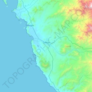
Name: Casma topographic map, elevation, terrain.
Location: Casma, Provincia de Casma, Áncash, Perú (-9.79485 -78.39836 -9.20092 -77.96482)
Average elevation: 400 m
Minimum elevation: 0 m
Maximum elevation: 4,068 m
Other topographic maps
Click on a map to view its topography, its elevation and its terrain.
Santa Matilde
Perú > Áncash > Casma > San Francisco
Santa Matilde, San Francisco, Casma, Áncash, Perú
Average elevation: 139 m