
Alcácer do Sal topographic map
Interactive map
Click on the map to display elevation.
About this map
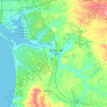
Name: Alcácer do Sal topographic map, elevation, terrain.
Location: Alcácer do Sal, Setúbal, Portugal (38.17840 -8.82276 38.55310 -8.12970)
Average elevation: 77 m
Minimum elevation: -3 m
Maximum elevation: 412 m
Other topographic maps
Click on a map to view its topography, its elevation and its terrain.