
La Vega topographic map
Interactive map
Click on the map to display elevation.
About this map
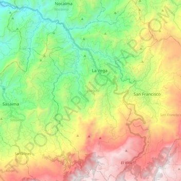
Name: La Vega topographic map, elevation, terrain.
Location: La Vega, Gualivá, Cundinamarca, 253610, Colombia (4.88360 -74.39590 5.07327 -74.27878)
Average elevation: 1,659 m
Minimum elevation: 704 m
Maximum elevation: 3,028 m