
Charlotte County topographic map
Interactive map
Click on the map to display elevation.
About this map
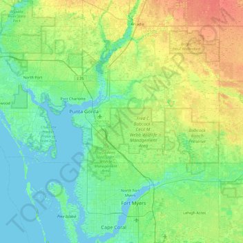
Name: Charlotte County topographic map, elevation, terrain.
Location: Charlotte County, Florida, Verenigde Staten (26.76955 -82.43733 27.03529 -81.56220)
Average elevation: 10 m
Minimum elevation: -1 m
Maximum elevation: 32 m